By Thomas R Murphy, Olivia Wilson, Shaun Lewin, and Gillian Glegg
This Plain Language Summary is published in advance of the paper discussed. Please check back soon for a link to the full paper.
Many local people witness environmental degradation (e.g. water pollution) and want to be better stewards of the environment. Access to spatial environmental data has never been better, with a wide range of open-source information now available. However, many local communities still find it difficult to use this data because of the complexity of mapping tools and the technical knowledge required to use the data. This can be a barrier to local people getting involved in environmental decision-making or taking action to improve their natural surroundings, and for improved human-nature interactions. We wanted to understand whether working with communities to design a simplified mapping tool which was defined by using natural catchment boundaries could better support community engagement and use of environmental data?
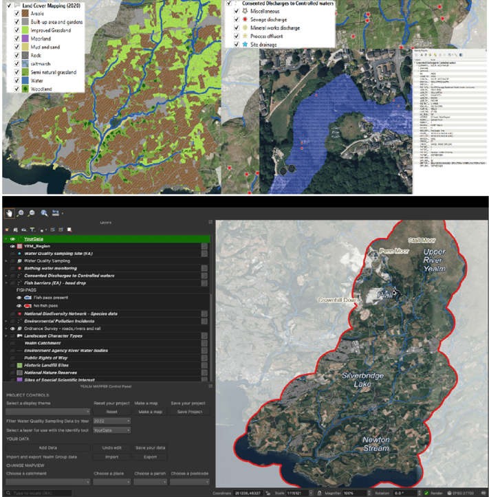
This study worked with an environmental group called ‘Yealm Estuary to Moor’ (YEM), based in the River Yealm catchment in south Devon, UK. The study ran community workshops to co-develop a customised mapping tool using open-source Geographical Information Systems (GIS) and open source environmental data. The tool was designed to help community members better access, understand, and use environmental data specific to their local area. Whilst it is becoming more common for people to use participatory mapping approaches to develop maps that support local empowerment, it is much rarer for community members and users to develop the mapping platform.
Participants in the workshops were keen to explore data on topics like water quality and biodiversity and use the tool to support both individual and group projects to improve river health. The study found that there was a range of engagement levels by participants. Whilst some participants wanted to use the tool simply to learn about their area, others wanted to use it to collect and analyse their own data. However, some found the tool quite technical, which limited how easily they could engage with it, highlighting the need for more research to explore usability of open access data and participatory GIS.
The study showed that tailored mapping tools can help make complex environmental data more accessible and useful for local communities. The study develops and proposes a “pyramid of engagement” to show how different people might interact with the tool, from simply viewing data to actively contributing new information and potentially leading new projects. The approach could help bring together different community and organisational efforts to better care for local environments. However, the study suggests there are still significant usability constraints that future development of the tool might help overcome. The study also suggests the tool could be adapted for use in other places and online.
The study provides a case example of how a local stakeholder informed and designed GIS might empower community led environmental stewardship, potentially helping communities feel more informed and able to take meaningful action to monitor and improve the natural environment around them.

