Artwork: Briony Penn.
By Megan Adams, Vivitskaia Tulloch, Jessie Hemphill, Briony Penn, Leya Anderson, Kate Davis, Stephanie Avery-Gomm, Alex Harris, and Tara Martin.
This Plain Language Summary is published ahead of the article discussed; please check back for a link to the full paper.
Cumulative effects are changes in the environment caused by multiple interactions among human activities and natural processes that accumulate over years across land and seascapes.
There is broad consensus in Canada and beyond that the assessment and management of cumulative effects does not effectively protect biodiversity, especially through the lens of local and Indigenous perspectives. As such conflict surrounds many major development projects in Canada (e.g., Coastal Gas Link and Ring of Fire). This is largely because the cumulative effects assessment process in Canada is driven by proposed major industrial projects and does not effectively consider additional historic and ongoing impacts in a region. Cumulative effects assessments generally also fail to respect and incorporate Indigenous values or knowledge. Collectively, these tensions are contributing to conflict in various land and marine developments in Canada and beyond.
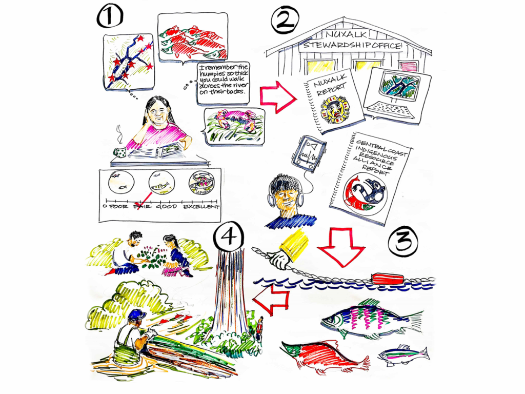
Our goal with this work was to offer a process for assessing cumulative effects that was inclusive to diverse knowledge holders and grounded in local values. We designed a regional cumulative effects assessment around the guiding principles of respecting Indigenous sovereignty and regional autonomy, designing for trauma-informed approaches, and prioritizing inclusivity and reciprocity. We collaborated with governments of the Kitasoo Xai’xais, Nuxalk, and Wuikinuxv First Nations in what is now known as the Central Coast of British Columbia, focusing our efforts on identifying historic, current, and future pressures on species of the Nations’ choice. Our team was made up of women from Indigenous, Chinese, and white-settler descent trained as ecologists, geographers, community planners, facilitators, and artists. We bring with us the lessons and accountabilities that stem from our relationships in this region as the basis of our work here.
We relied on expert knowledge holders alongside data-driven approaches to map current and future cumulative impacts and predict consequences for species’ health. Artists and facilitators allowed us to communicate and integrate the experts’ contributions alongside our mapping and modeling results. We found a diversity of elicitation processes (visualizations, numerical, oral, and written materials) fostered the involvement of a variety of experts (e.g., Indigenous knowledge holders and Nation staff, regional biologists, Crown managers, tenure holders).
We mapped over 90+ impacts to species in the region and after conversation and facilitated elicitation processes with over 50 knowledge holders, we emerged with predictions for the consequences of seven plausible scenarios of future cumulative impacts for eight species. Those predictions will help us model future consequences in development scenarios for the region so decision makers can weigh the ecological costs and benefits of potential actions.
Our hope is that our shared lessons can support researchers, planners, proponents, and Indigenous and colonial government agencies to conduct cumulative effects assessments that are locally relevant and inform regional relevant land and marine use planning.
