By Ricardo Ismael Mata-Páez, Elisabeth Huber-Sannwald, Natalia Martínez-Tagüeña, Ruperto Cázares-Reyes, Víctor Manuel Reyes-Gómez, Juan José López-Pardo, and Sandra Hernández-Valdez
Rangelands are ecosystems where vegetation is suitable for livestock and wildlife grazing. Rangelands are one of the most widespread land use types on the planet, yet they are highly susceptible to the loss of cultural and biological diversity. For their conservation, deep understanding on their many functions is necessary. Different methods exist to monitor them. However, assessment and monitoring efforts must include the local knowledge of the ranchers who live and depend on these rangelands.
We built a collaborative team of scientists and local ranchers to jointly gain a comprehensive understanding of rangeland health in a dryland Biosphere Reserve in northern Mexico. This area features a complex landscape mosaic of inland dunes, vegetation bands, and bare soil where livestock, wildlife, and humans coexist. Each landscape unit is a vital piece of a larger “land puzzle” – distinct yet intrinsically interlinked, shaped by and shaping the land around it.
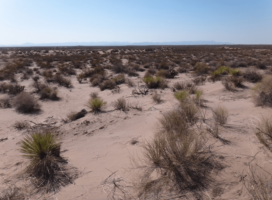
The llanos are bare soil areas—flat, open ground without vegetation—where rainwater easily flows across the surface. This water reaches the arenales, the sandy dunes that act like natural barriers. The arenales slow down the water flow, allowing it to seep into the soil and be stored. Thanks to this moisture, short-lived plants grow on the arenales during and after the rainy season. The mogotes are the vegetation bands consisting of dense patches of shrubs and grasses. These mogotes collect surface water flow, sediments and nutrients that are transported from the llanos and arenales, supporting the growth of a relatively dense cover of plants.
Mutual interests and a highly effective and trustworthy mode of collaboration allowed us to understand this landscape holistically. Hence, we co-designed a new tool to collectively monitor and evaluate rangeland health. This tool is the Integrated Rangeland Multifunctionality Index (IRMI). IRMI is a quantitative measure that incorporates local and scientific knowledge to determine the condition of a rangeland. This approach can be adapted to different rangeland systems worldwide. It generates valuable knowledge from a bottom-up perspective and contributes to the sustainable management of this land-use system type. Working together, we as ranchers and scientists learned a new way of seeing, understanding, and caring for drylands.
