Figure designed by Andrew Schendl.
By Andrew Schendl, James M. Bullock, Ronaldo Menezes, and Simon Willcock.
Urban parks and green spaces are vital for our health and well-being, especially as cities heat up with climate change. City planners often aim for the “x-minute city” where everyone can reach a park within a short walk or cycle ride. But measuring only the distance to parks misses a crucial question: why do people choose to visit or avoid certain parks even when parks are nearby?
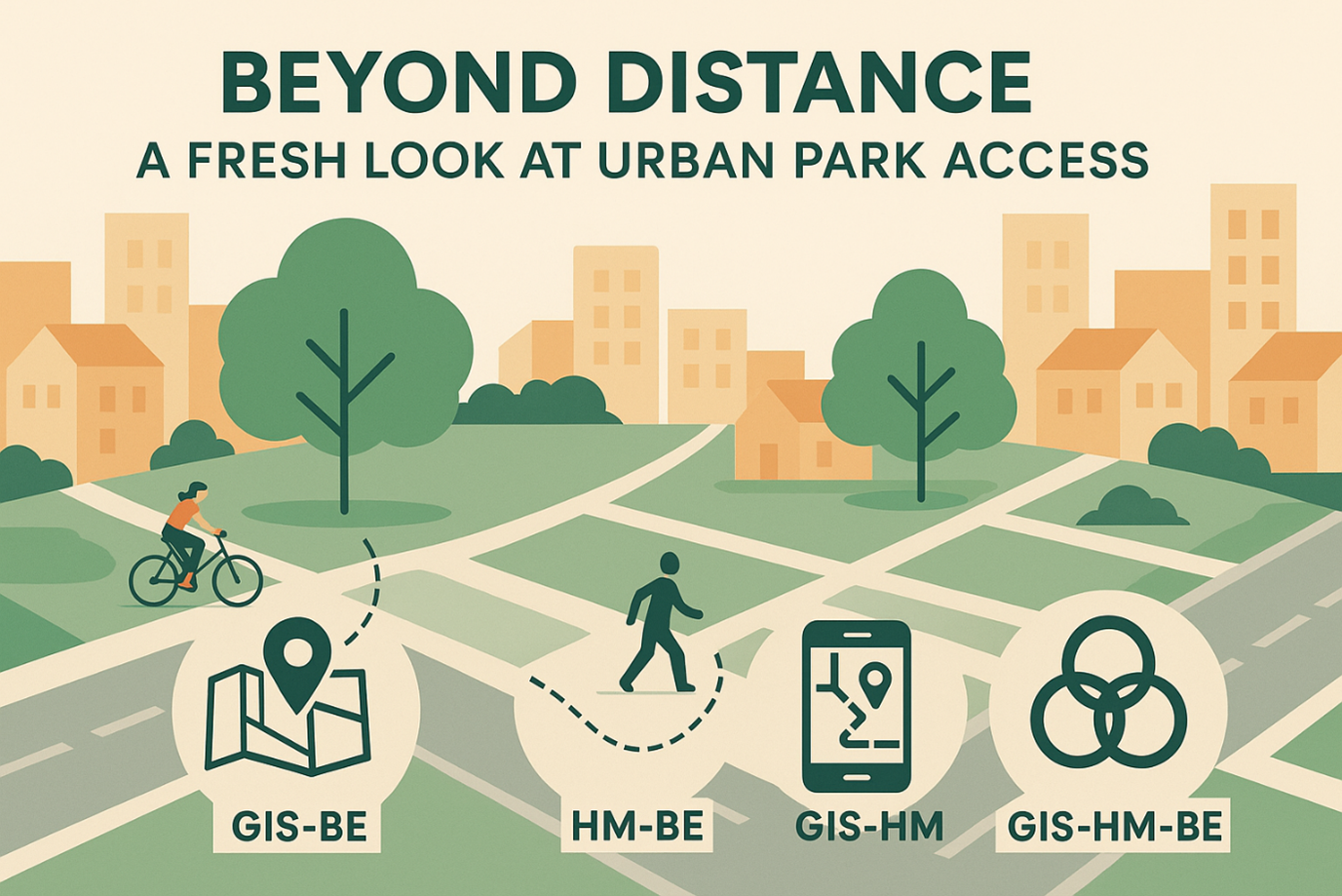
We looked at how three different approaches could give us a better picture of park access. Geographic information systems (GIS) help us map where parks are located, and which neighbourhoods lack green space. Behavioural ecology explains why people choose specific parks based on factors like safety or amenities. And human mobility data from mobile phones or GPS shows the actual routes people take to green spaces.
By combining these approaches in our “Multi-context Inclusive City” framework, we created four different ways to analyse park access. We can now examine how park locations interact with people’s preferences (GIS-BE), how movement patterns connect to decision-making (HM-BE), how mapped locations compare to actual travel paths (GIS-HM), and finally, how all three elements work together (GIS-HM-BE). This helps explain why some parks remain empty despite being close to neighbourhoods – perhaps they feel unsafe, lack convenient entry points, or don’t match cultural preferences.
Our framework gives city planners powerful new tools to ensure everyone has meaningful access to nature, not just on paper but in practice. This matters because truly accessible green spaces create healthier communities and more sustainable cities for all.
